Chapter 5
The Geoscope
2ONE OF THE WORLD-AROUND’S most immediately critical problems is that of how to facilitate the swift development of all human individuals’ discovery of all we know about human life on board Spaceship Earth at this moment in Universe—and how so to learn in the shortest possible time.
3 We have already referred many times to the world’s pro tem power-structure-wrought obstacles blocking the critical path to human understanding of the nature of reality.
4 In the Victorian era, into which I was born, reality was everything we could see, smell, hear, taste, and touch. That is what reality had always been.
5 When I was three years of age, the electron was discovered. Science said the electron was a nonconceptual phenomenon. Because it was invisible, it could not be photographed…and it didn’t ‘‘make the news.’’ The electron was very real, however, because it could give you a shock—could even electrocute you. The new reality being invisible, approximately 99.9 percent of twentieth-century science was leading industrial technology’s everyday, working reality into the ultra- and infravisible—the macro-astrophysical and the microatomic, electronic, metallurgically alloying, chemically reacting, microbiologically, astrophysically exploring ranges of the electromagnetic wave spectrum of Universe. And 99.9 percent of these very real activities are nondirectly apprehensible by the bare human senses and are practically discovered and coped with only through powerful macro-micro operative instruments.
6 At the dawning of the twentieth century, without warning to humanity, the physical technology of Earthians’ affairs was shifted over from a brain-sensed reality into a reality apprehended only by instruments, comprehended only by scientifically trained brains, understood and coped with only by experience-educated mind, and employed usefully only through mind’s discovery and objectification of special case realizations of the only mathematically expressible laws governing each of the omni-intercomplementary family of scientific generalizations.
7 We have also noted how the power structures successively dominant over human affairs had for aeons successfully imposed a ‘‘specialization’’ upon the intellectually bright and physically talented members of society as a reliable means of keeping them academically and professionally divided—ergo, ‘‘conquered,’’ powerless. The separate individuals’ special, expert glimpses of the separate, invisible reality increments became so infinitesimally fractionated and narrow that they gave no hint of the significant part their work played in the omni-integrating evolutionary front of total knowledge and its power-structure exploitability in contradistinction to its omnihumanity-advantaging potentials. Thus the few became uselessly overadvantaged instead of the many becoming regeneratively ever more universally advantaged.
8 Hyper-specialization also prevented popular comprehension of what the ongoing world power structure was doing—ergo, hyperspecialization kept society preoccupied in ways non-detrimental to the power structure’s interests and practically dependent upon the power structure’s media for information.
9 In addition to (A) the difficulties of popular comprehension imposed by the invisibility of the frontiers of everyday reality, and (B) specialization as an obstacle to popular apprehension and comprehension of ‘‘what life is about’’—which obstacles A and B must be effectively vanquished within the 1980s if humanity is to continue on our planet—we now discover another formidable obstacle that must also be vanquished by 1990. That obstacle (C) is humanity’s inability to see more than a very limited number of rates of motion. Humans cannot see humans growing either bodily or as local human tissue. Humans cannot see the motion of the hour and minute hands of the clock or of the physical growth of trees. Humans can realize only retrospectively that they have grown because their clothes no longer fit. Humans find that trees have grown because yesteryear’s view has been cut off—99.9 percent of what humans can ‘‘see’’ comprehendingly is the belated after effects of what happened.
10 Most of the important trend patternings are invisible—ergo, their eventuations are unanticipated by society. Because of obstacles A, B, and C most of the significant evolutionary trendings of human affairs cannot be detected and tuned in by people’s sense-coordinating brains. Few of their vital challenges are apprehended in time by human brains. When humans cannot see something approaching to destroy them, they do not get out of the way.
11 Question: Is there not an instrument that can inform humanity about its invisibly trending evolutionary challenges—and do so in time to allow them to satisfactorily anticipate and cope with inexorable events? Yes! There is the Geoscope, which can be swiftly realized both physically and metaphysically.
14 Only for six one-thousandths of its three and one-half million known years of presence on Earth has humanity sensed the shape, size, rotation, and Sun-orbiting rate of our planet in the solar system as well as our Earth’s relationship to other micro-macro-Universe events. Only human mind’s capability to discover the only-mathematically-definable-and-employable physical laws—of the everywhere and everywhen nonsimultaneously intertransforming, differently enduring, differently energized, independently episodic and overlapping, eternally regenerative, scenario Universe’s laws such as those of leverage, electromagnetics, and optics—has made possible humanity’s additional discovery and participatory use of macro-micro-Universe information.
15 ‘‘Oh wad some power the giftie gie us to see oursels as others see us.’’ To facilitate humanity’s comprehension of its present status in Universe, what is needed is a sensorially tune-in-able physical means of ‘‘seeing oursels as others see us.’’
16 Poet Robert Burns’s wish was partially fulfilled when, for the first time, Earthian humans standing on the Moon took colored moving pictures of our planet Earth exactly as seen from the Moon and electromagnetically dispatched the pictures back to us on Earth to be seen over anybody’s and everybody’s properly tuned-in television sets.
17 Most people will say that if you want to get the best map of the whole world, use a globe, the bigger the better. The trouble with a globe is that you cannot possibly see all the world displayed on it at any one time. The experimentally disclosed fact is that, without revolving the library Earth globe, you cannot read the names identifying the geographical data of more than one-quarter of its surface at any one viewing.
18 You may say ‘‘the larger the globe, the more you can see of the world in any one viewing.’’ If that were true, you could use the real Earth as your optimum globe. The fact is that the bigger the globe, the less of its surface data you can see and read at any one time. With a twelve- or sixteen-inch globe you can get the most information possible in any one viewing. This is approximately one-quarter of the Earth’s surface.
19 Because humans want to see their whole Earth at once, cartographic projections of the Earth’s surface were developed—Mercator, polyconic, polar azimuthal, etc. The Mercator became the most familiarly used. It is as yet found in 1980 to be the map most frequently used in schools around the world. On it Greenland will often be seen to be larger than South America, and North America larger than Africa; it has no Antarctic continent; and the land on the left end of the map is seemingly 24,000 miles away from the land area on the right end while in reality those areas are actually adjacent. With only one exception—the Fuller Dymaxion Projection-all of the well-known methods of cartographic projection either chop the world data into a number of separately viewed parts or produce badly distorted images and continental fractionations.
20 It was to provide a satisfactory means for humanity to see correctly the entire surface of the globe all at the same time that the Dymaxion Sky Ocean Projection was designed. With it, for the first time in history, humans can see their whole planet Earth’s geography displayed on one flat surface without any visible distortion in shape or relative size of any of its data and without any breaks in its continental contour—that is, the whole world surface is viewable simultaneously as one-world island of unbroken contour in one-world ocean.
21 The Dymaxion transformational projection system that produces the Sky Ocean World Map divides the sphere into its maximum omnisymmetrical, twelve-vertexed, thirty-arc-edged subdivisions of twenty equi-central-angled arcs of 63° 26’ and sixty surface angles of 72° each, spherical triangles. The thirty great circle arcs of 63° 26’ act as constant peripheral integrity controls, preventing the breaking open and spilling out of the discrete data and distorting of the constant angular symmetry, both central and surface, during the transformation from spherical to planar display of the twenty triangles of the spherical and planar bound icosahedron.
22 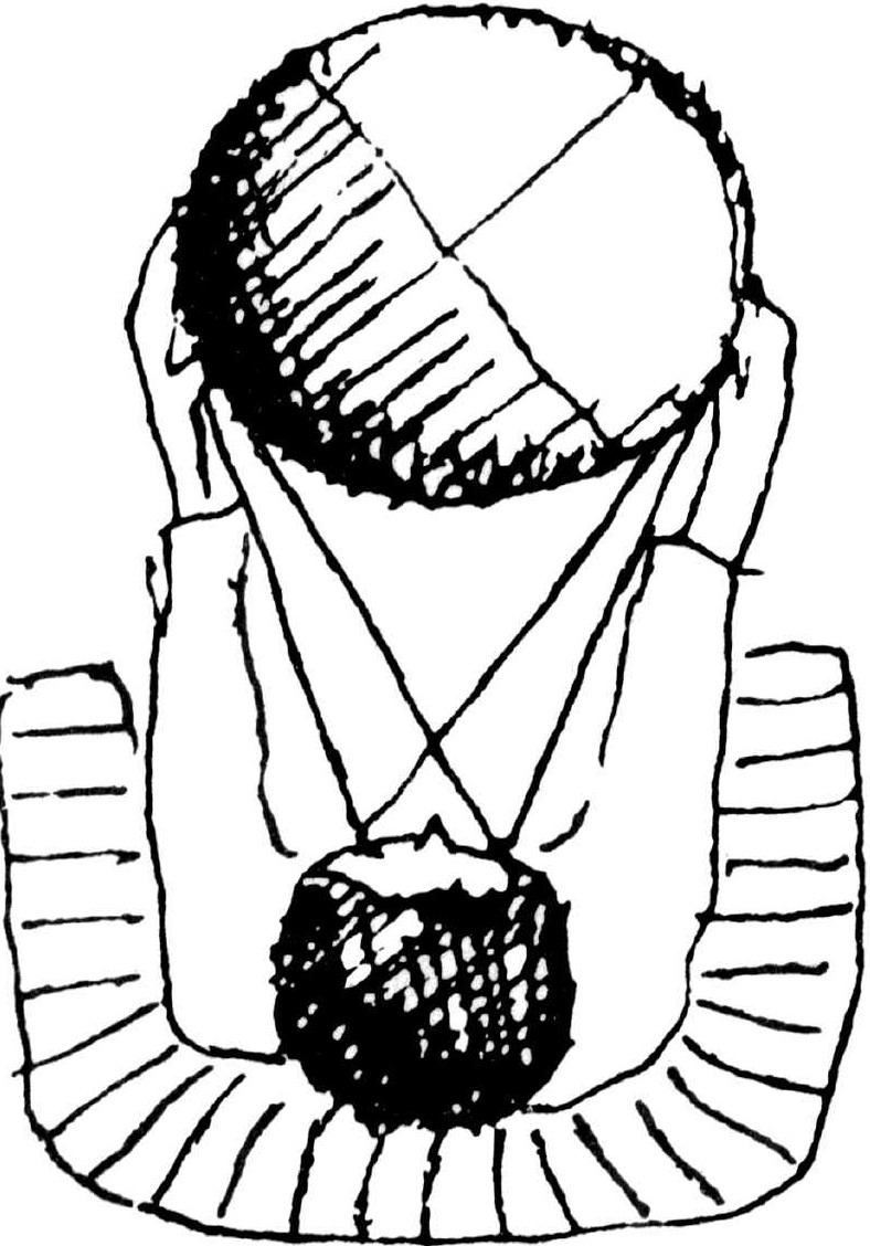 Bird’s-eye view of person looking at a sixteen-inch world globe. FIGURE 25
  Change: Fix Fig 25
23 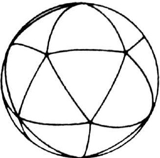
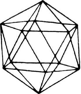
 FIGURE 26
  Change: Fix Fig 26
24 

 FIGURE 27
  Change: Fix Fig 27
25 FIGURE 28  Change: Fix Fig 28 FIGURE 29
  Change: Fix Fig 29
26 The more conventional projection systems that are widely used include the Mercator
projection (Fig. 27) Change: Add ref , the conic projection (Fig.
28)
Change: Add ref , the conic projection (Fig.
28) Change: Add ref , and the polar azimuthal projection (Fig.
29)
Change: Add ref , and the polar azimuthal projection (Fig.
29) Change: add ref . All three of these systems give rise to
considerable visual distortion, which the Dymaxion projection avoids (see Fig. 30)
Change: add ref . All three of these systems give rise to
considerable visual distortion, which the Dymaxion projection avoids (see Fig. 30) Change: add ref .
27 
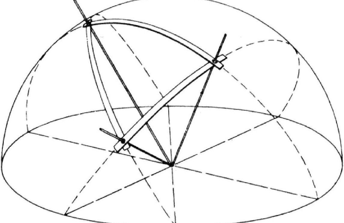
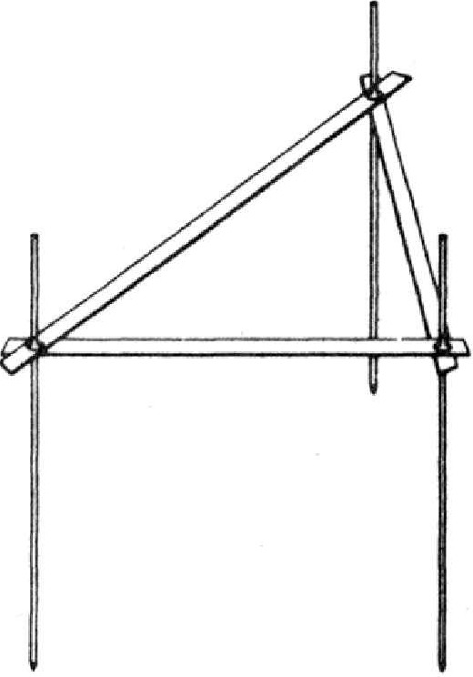
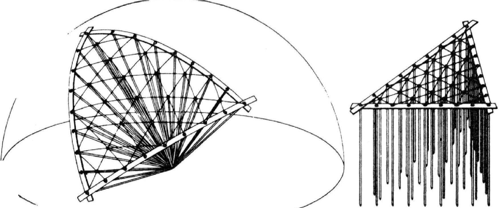
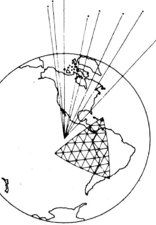
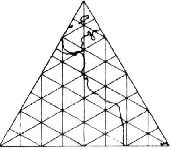 FIGURE 30.
  Change: Fix Fig
30
Change: Fix Fig
30
30 In 1964 the United States Information Agency asked me to consider the design of a building and an exhibition that might be adopted as the United States entry in the Montreal World’s Fair of 1967, later known as ‘‘Expo ‘67.’’
31 I made a proposal, and the exhibition part of it was rejected. I was asked to continue, however, as the architect of the U.S.A. building to house an exhibition designed by others. Insofar as I know, I was the only one considered as architect of the building. I think this was because of the success the United States had experienced with my 1954 world-around, air-delivered, geodesic-dome trade fair pavilions and the U.S.A. Moscow Exhibit dome of 1959, which was purchased by the Russians as a permanent building after the United States exhibition was concluded.
32 Fortunately my U.S.A. geodesic dome for Expo ’67 proved a success. Also, but more gradually, it is being realized by many that my rejected idea for the American exhibit is looming into ever greater prominence as a highly desirable social facility. I will therefore review the concept and development of my original idea.
33 I told the United States Information Agency in 1964 that by 1967 the regard of the rest of the world for the United States would be at its lowest ebb in many decades—if not in the total two centuries of the U.S.A.’s existence. Since each country’s World’s Fair exhibit would be well published all around Earth, I felt that it would be very important that the United States do something that would tend to regain the spontaneous admiration and confidence of the whole world. This could be done by inaugurating at Expo ‘67 a computerized exploration for the most universally creative and economically sound internal and external U.S.A. policy formulation.
34 What I proposed was based on my observation that world people had become extraordinarily confident in the fundamental reliability of the computer and its electronically controlled processes. I know that a great many people will contradict me, but I had predicated my conviction of society’s subconsciously established confidence in the computer’s reliability upon vital, therefore undeniable, behavior facts.
35 On the working assumption that humanity had established implicit confidence in the computers and automated instrumentation, I proposed in 1964 that the United States Expo ‘67 exhibition should have a 400-foot-diameter 5/8 sphere building similar in shape to the 250-foot-diameter building actually built for Expo ’67. In the basement of this building would be housed an extraordinary computer facility. On entering the building by thirty-six external ramps and escalators leading in at every ten degrees of circumferential direction, the visitors would arrive upon a great balcony reaching completely around the building’s interior quarter-mile perimeter. The visitors would see an excitingly detailed 100-foot-diameter world globe suspended high within the 400-foot-diameter 5/8 sphere main building. Cities such as New York, London, Tokyo, and Los Angeles would appear as flattened-out, basketball-sized blotches with the tallest buildings and radio towers only about one-sixteenth of an inch high.
36 Periodically the great spherical Earth would be seen to be transforming slowly into an icosahedron—a polyhedron with twenty (equilateral) triangular facets. The visitors would witness that in the processes of these transformations there are no visible changes in the relative size and shape of any of the land and water masses of the 100-foot-diameter miniature Earth. Slowly the 100-foot-diameter icosahedronal Earth’s surface would be seen to be parting along some of its triangular edges, as the whole surface slowly opens mechanically as an orange’s skin or an animal’s skin might be peeled carefully in one piece. With slits introduced into its perimeter at various places it would be relaxed to subside into a flattened-out pattern as is a bearskin rug. The icosahedronal Earth’s shell thus would be seen to gradually flatten out and be lowered to the floor of the building. The visitors would realize that they were now looking at the whole of the Earth’s surface simultaneously without any visible distortion of the relative size and shape of the land and sea masses having occurred during the transformation from sphere to the flattened-out condition we call a map. My cartographic projection of the ‘‘Sky-Ocean World’’ functions in just such a manner as I have just now described.
37 This stretched-out, football-field-sized world map would disclose the continents arrayed as one world-island in one world-ocean with no breaks in the continental contours. Its scale would be 1/500,000th of reality. Three millimeters or one eighth of an inch would represent a mile. A big 1000-foot-long oil tanker would appear to be less than one millimeter or only one fiftieth of an inch in length. A major airport’s runways would each be about three millimeters or one eighth of an inch long. A major football stadium would measure less than one millimeter or one fiftieth of an inch long at this scale.
38 The great map would be wired throughout so that mini-bulbs closely installed all over its surface could be lighted by the computer at appropriate points to show various, accurately positioned, proportional data regarding world conditions, events, and resources. World events would occur and transform on this live world map’s ever-evoluting face. If we had 100,000 light bulbs for instance, each mini-light-bulb could represent 40,000 people-a medium-sized town. Mexico City, New York City, or Tokyo would be a cluster of 250 bulbs. The bulbs could be computer-distributed to represent the exact geographical distribution positioning of the people. Military movements of a million troops would be dramatically visible. The position of every airplane in the sky and every ship on the world ocean could be computer-control displayed. Weekend and holiday exoduses from cities into the country or travel to other cities would be vividly displayed by computer-controlled tallying instruments.
39 I proposed that on this stretched-out, reliably accurate, world map of our Spaceship Earth a great world logistics game be played by introducing into the computers all the known inventory and whereabouts of the various metaphysical and physical resources of the Earth. (This inventory, which took forty years to develop to high perfection, is now housed at my head quarters.)
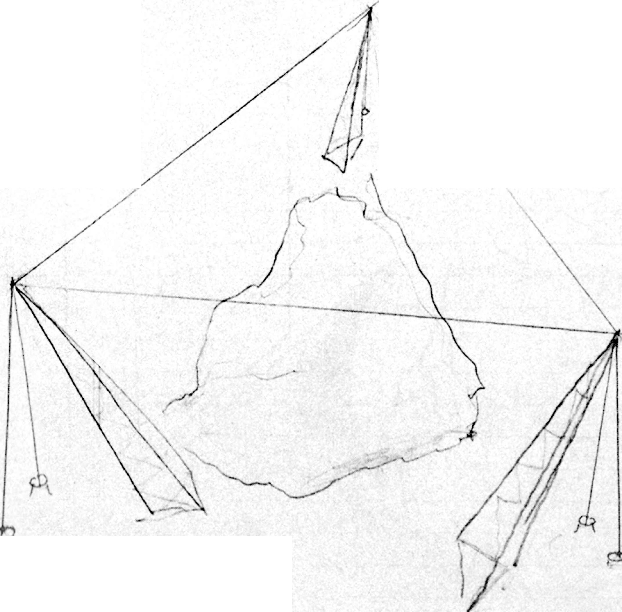
40 We would then enter into the computer all the inventory of human trends, known needs, and fundamental behavior characteristics.
41 I proposed that individuals and teams would under-take to play the World Game with those resources, behaviors, trends, vital needs, developmental desirables, and re-generative inspirations. The players as individuals or teams would each develop their own theory of how to make the total world work successfully for all of humanity.
42 Each individual or team would play a theory through to the end of a predeclared program. It could be played with or without competitors.
43 The objective of the game would be to explore ways to make it possible for anybody and everybody in the human family to enjoy the total Earth without any human interfering with any other human and without any human gaining advantage at the expense of another.
44 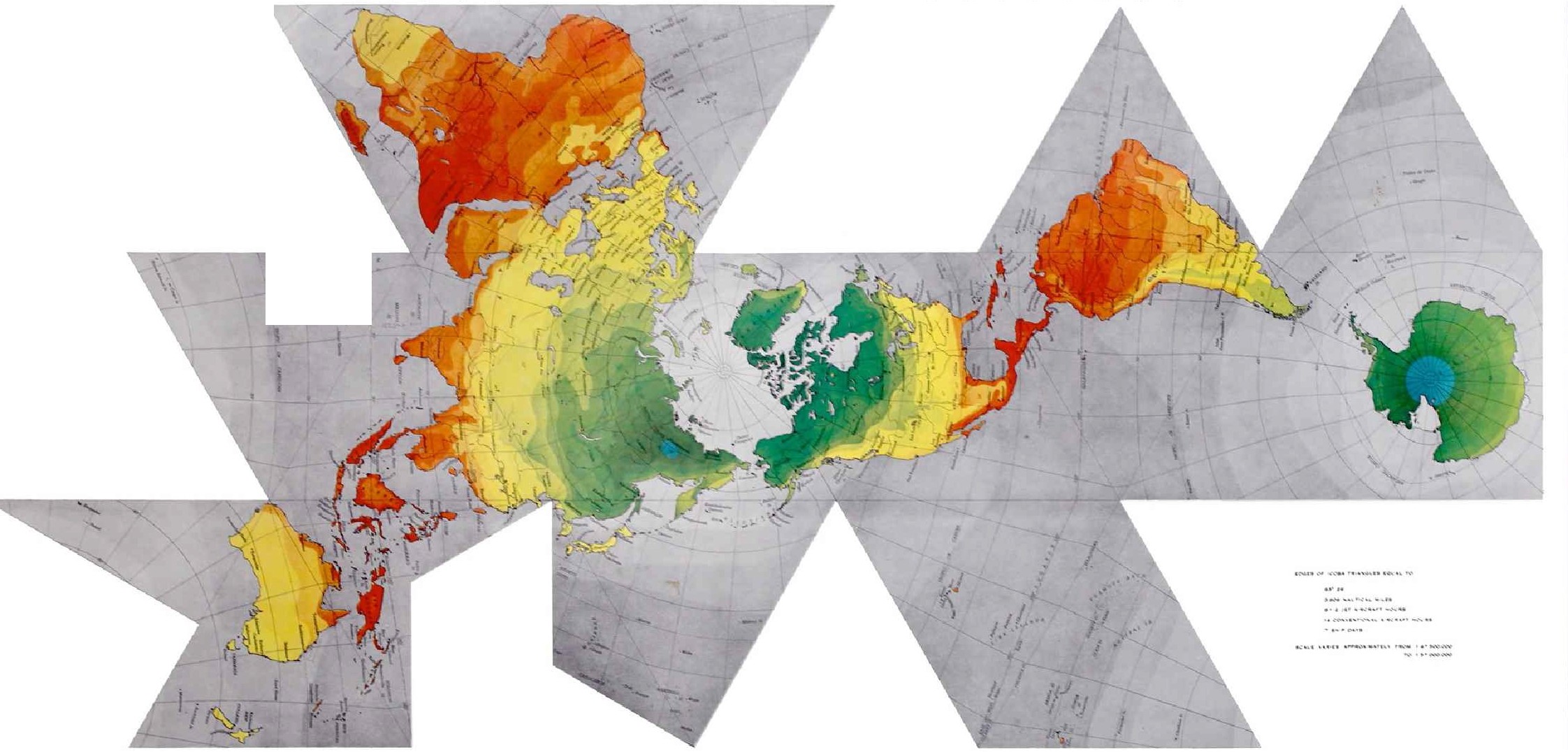 FIGURE 31. Dymaxion Sky-Ocean World Map
45 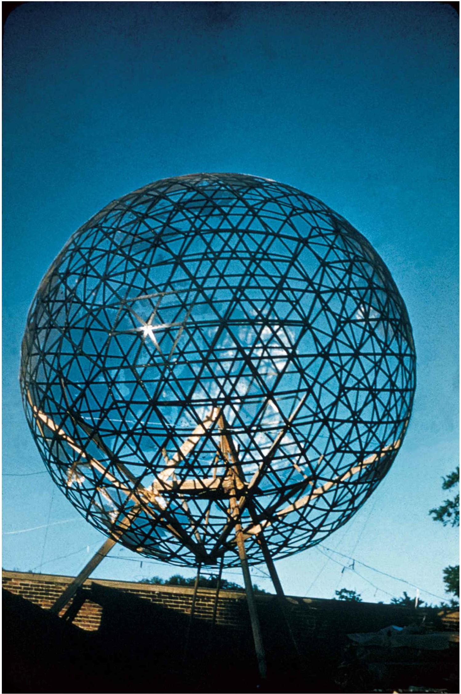 FIGURE 32. Cornell Geoscope
46 To accomplish the game’s objective the resources, pathways, and dwelling points around the surface of our 8000-mile-diameter, spherical Spaceship Earth must be fully employed by the players in such a way that the world’s individual humans would each be able to exercise complete actional discretion and would have such freedom of decision regarding the investment of their time in their waking hours that they would be able to travel independently, or in groups, either to and fro locally or continuing intermittently on around the world, dwelling from time to time here or there, finding everywhere facilities to accommodate their needs in an uncompromising manner.
47 The game would seek to use the world’s resources, inter-processes, and evolutionary developments in such a way that all the foregoing would be possible.
51 It was to satisfy the same need of humanity-to comprehend the total planetary, all-evolutionary historical significance of each day’s developments-that the 200-foot, or sixty-meter, -diameter Geoscope was developed. The Geoscope is a gossamer, open trusswork spherical structure wherewith humanity can see and read all the spherical data of the Earth’s geography as seen from either its inside or its outside and in its proper interorientation within the theater of local Universe events.
52 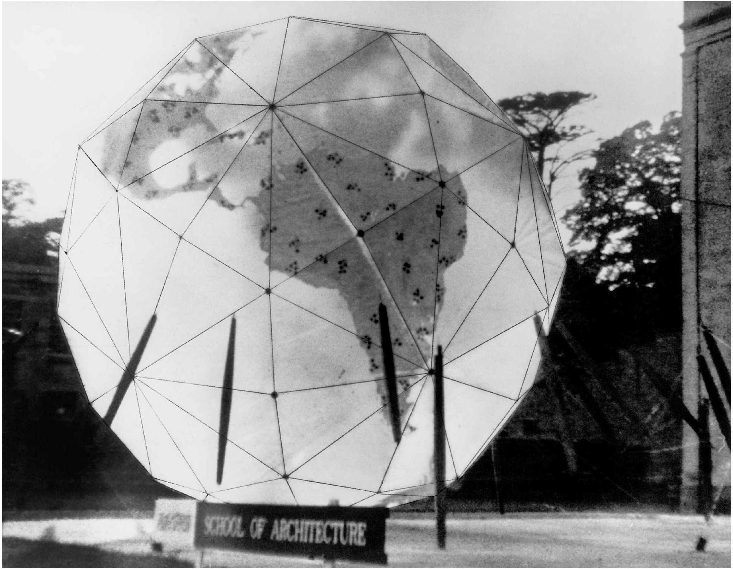 FIGURE 33 Nottingham Geoscope
53 When completely installed and ready for use, all Geoscopes are oriented so that their polar axes are always parallel to the real Earth’s north-south polar axis, with the latitude and longitude of the installed Geoscope’s zenith point always corresponding exactly with the latitude and longitude of the critically located point on our real planet Earth at which the Geoscope is installed. As a consequence of the polar axis and zenith correspondences of the Geoscope mini-Earths and the real Earth, it will be found that the miniature Earth Geoscope’s real omnidirectional celestial-theater orientation always corresponds exactly with the real omnidirectional celestial-theater orientation of the real planet Earth.
54 Since the two spheres (mini-Earth and real Earth) are rigidly coupled together tangentially at the same latitude-longitude point on the real Earth as the latitude-longitude zenith point on the Geoscope sphere, the geographical-geometrical orientation attitudes brought about by their respective axial rotations and orbital travel around the Sun will be identical. The Geoscope has the same relationship to the Earth as has one of the relatively small lifeboats mounted fore and aft on the davits of an ocean cruise ship to the big ship herself. If the big ship changes its course from north to east, the lifeboat does likewise. If the bow rises and falls in a head-on sea, so too does the bow of the davits-mounted lifeboat.
55 The 4000-mile—1/46th light-second—distance existing between the center of the Earth sphere and that of the Geoscope sphere mounted on the Earth’s surface is astronomically negligible when compared to any of the celestial distances. The distance from Earth to its nearest star-the Sun-is 92 million miles, or eight light-minutes, away. The next nearest star is 25 trillion miles away. Such celestially negligible distances as 4000 miles are canceled out as visibly unappreciable. Such negligible distances are called ‘‘parallax’’ by the astronomer or navigator.
56 Standing at night with your eyes at the center of such a Geoscope—miniature Earth-and viewing the stars outwardly through its fly-screen surface, on which are thinly outlined all the contours of all the world’s continents, you will see the exact relationship of all the stars to the Earth’s surface. Any star in zenith over any one geographical point on the Earth can be verified to be in zenith at that moment over that point on Earth by telephoning someone at that point. What you will see from the center of mini-Earth at any one time is exactly what you would see if you were safely stationed at the center of real planet Earth and had X-ray eyes and could look outwardly through 4000 miles of matter to see the stars viewable in zenith outwardly of any one given geographical point of our axially spinning, Sun-orbiting, sphere Earth at any one given moment. As viewed from its center, Geoscope becomes a true planetarium—no imitation stars and no imitation sky. In the Geoscope we have the real stars in their real sky in exact zenith position as seen through the Geoscope’s spherical triangle windows outwardly and around our
57 Earth sphere in all directions as of any given moment—as our Earth revolves and zooms along its Sun orbit within that vast starry environment.
58 Because the real planet Earth is revolving around its north-south polar axis, so, too, is mini-Earth. They are both thus revolving without effecting any change of the observed position of Polaris—the North Star—in respect to mini-Earth’s north pole. Therefore, the observer at the center of the Geoscope feels spontaneously the celestial fixity not only of Polaris but also of all the other stars as seen outwardly through the Geoscope’s triangular windows. Because outwardly of Geoscope’s equator what we can see of the starry scene is changing most rapidly and ever less rapidly until, looking out along the polar axis, we observe no change, we get the same feeling as we do looking out the window of a railway car, automobile, or airplane. We see and feel the scene changing as a consequence of our vehicle’s motion and not of the scenery’s motion. For the first time in human experience Geoscope’s mini-Earth spherical structure is clearly seen and felt to be revolving within the theater of Universe, and those holding steady their bodies, heads and their eyes and standing at the Geoscope’s center, feel-see their Earth revolving within the vast theater of the starry sky.
59 With Geoscopes locally available around the world, all children experiencing its true celestial-event orientations will feel themselves being rotated around from west to east by the Earth to be shaded from the Sun’s light by the rolling-around Earth’s western horizon…which deep shadowing they will call night.
60 They will feel their western horizon to be rotating around with them and to be obscuring (or eclipsing) the Sun. They will spontaneously say ‘‘Sunclipse’’ instead of ‘‘Sunset.’’ In the same way they will say spontaneously ‘‘Sunsight’’ in the morning as the Earth revolves the Sun into seeability, thus spontaneously acquiring two poetical, two-syllable, truly meaningful words to replace the two-syllable, misinformative, but poetical words of their ancestry—‘‘Sunset’’ and ‘‘Sunrise.’’
61 The new educational technology of world man will have eventual, emergency-emerged, critical necessity come to produce and use the Geoscopes as basic educational tools for acquiring both cosmic and local Universe orientation. It will be universally used as the visual reference for all hourly news broadcasts everywhere around the Earth. Geoscope will spontaneously induce total-Earth, total-humanity viewing significance in regard to all our individual daily experiences. It will spontaneously eliminate nationalistic cerebrating.
62 The most usefully informative model of the Geoscope now under consideration is a 200-foot-diameter, structurally gossamer, look-into-able and look-out-able, geodesic sphere to be suspended with its bottom 100 feet above ground by approximately invisible cables strung tautly from the tops of three remotely erected 200-foot-high masts.
63 The vast number of computer-selected, colored, miniature electric light bulbs displayed on the spherical frame’s surface of the 200-foot-diameter Geoscope, with their dolensity and diminutive size as well as their minimum distance of 100 feet from viewing eyes (as seen from either the center of the sphere or from the ground outside and 100 feet below), will altogether produce a visually continuous-surface picture equal in detailed resolution to that of a fine-screen halftone print or that of an excellent, omnidirectionally viewable, spherical television tube’s picturing. It may well be that by the time the first 200-foot Geoscope is undertaken, we may be able to develop a spherical TV tube of that size or a complex of spherically coordinated TV tubes. This giant, 200-foot-diameter sphere will be a miniature Earth—the most accurate global representation of our planet ever to be realized.
64 I have produced several fully working, lesser-diameter models of such Geoscope (or mini-Earth) facilities. Most notable were the twenty-foot-diameter one at Cornell University in 1952; the semicompleted, 200-foot-diameter one at the University of Minnesota in 1954--56; the ten-foot-diameter one at Princeton University in 1955; and, in semi-demonstrability, the 250-foot-diameter, 3/4 sphere, spherical structure used as the U.S.A. pavilion at Expo ‘67 in Montreal, Canada, in 1967; and the fifty-foot-diameter Geoscope permanently installed exactly astride the ninetieth meridian of our planet Earth as the Religious Center of Southern Illinois University’s campus at Edwardsville, Illinois, in 1970.
65 To our 1953--55 University of Minnesota and Princeton University Geoscope development classes I suggested that our first 200-footer should serve as an everyday facility of the United Nations. I proposed that it be triangularly suspended from the top of five 300-foot-high tower masts to be erected from a group of rock ledges in New York City’s East River—known on the government charts as Blackwell’s ledges. These ledges are situated in the middle of the East River a quarter of a mile south of what was once called Blackwell’s Island, then for thirty years Welfare Island, and in the 1970s was renamed Roosevelt Island. All the East River water traffic running between New York’s Lower Harbor and Long Island Sound or the Harlem River passes to the west of Blackwell’s ledges—that is, between the ledges and the United Nations buildings.
66 The tallest UN building is 400 feet high. I proposed that the 200-foot Geoscope sphere be hung above the ledges with its bottom 200 feet above the water, which would locate its top at the same 400-foot height as that of the UN building and 100 feet higher than the tops of the supporting masts. I proposed that the intercabling of the mast tops and their tangentially triangling support of and tie-down of the sphere be done with high-tensile and small-diameter, high-carbon rod steel, so delicate that the dull-black-plated support system would be invisible-the geodesic-tensegrity sphere being of such low weight as to make this invisibility highly feasible.
67 This would result in the 200-foot sphere seeming to be floating in midair as though it were a small celestial body that had come in very close to Earth at just the right location to make it highly visible to occupants of the UN building as well as to all those in New York City in the vicinity of Fiftieth Street.
68 In designing the optimum public Geoscope in 1950 I chose the 200-foot diameter, approximately transparent, gossamer-structured sphere because at that time the United States Air Force was, wherever possible, engaged in making radio-triangulated, geographically accurate photographic maps of the whole Earth’s surface. The airplane’s exact geographical position at the moment of photographing was determined by electromagnetics—geographical position fix by cross-triangulation from two known station points on Earth. This electromagnetic-beam-crossing triangulation, triggered by the camera, accurately identified the position of the airplane at the moment of its photographing of any one picture and as located on the latitude-longitude coordinate grid of our Earth’s planetary sphere. The Air Force’s geographical photography work was known as the aerial (photographic) mosaicking of the world.
69 With the U.S.A. entering into a third, but coldly conducted, ententingly competing, small-nation puppetry-manipulated world war with the U.S.S.R. and its allies, we can understand why it was that the U.S.A. was so intently flying those world-around, radio-triangulated photomosaic missions.
70 The mosaic grid was flown over all those countries of the world that permitted the U.S.A. to do so. Different series of the photographic mosaicking were flown at different altitudes. The lowest-flown altitude gave the greatest details. It was the communist countries’ prohibition against the U.S.A.’s photographic mapping that caused the U.S.A. to develop the Russian-shot down, ultra-high-flying U-2, hoping to accomplish the triangulation task.
71 The optimum Geoscope is designed to make practical an omnidirectional picture displayed on the surface of a large sphere for presenting all manner of information relevant to all human affairs as they occur around the whole of our planet, so that the whole world’s population can learn for itself how to comprehend the significance of the world-around information as compounded with other powerfully relevant, long-known, and broadcast news and other Geoscope-mounted information.
72 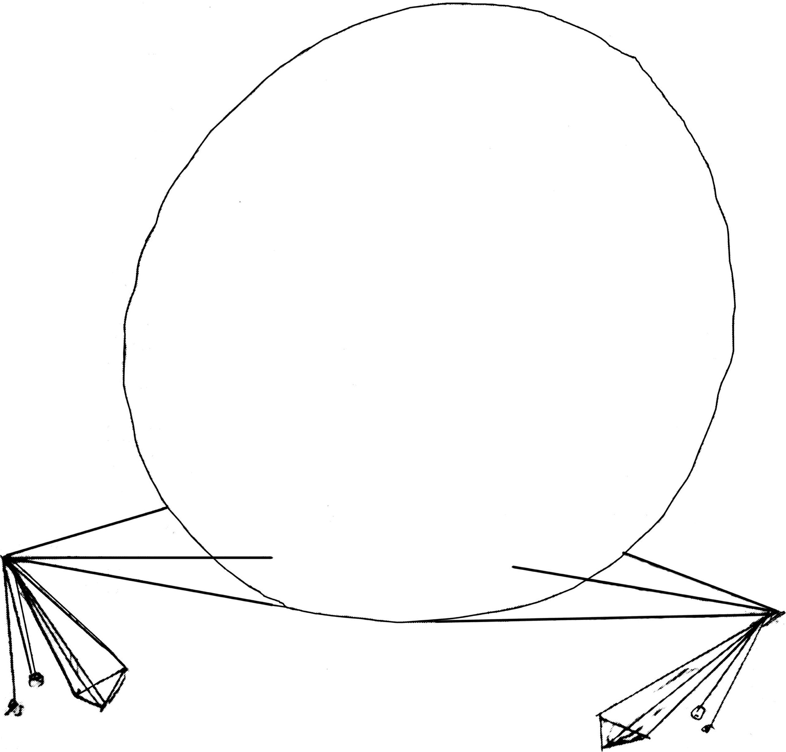 Drawing for proposed United Nations 300-foot Geoscope FIGURE
34.
Drawing for proposed United Nations 300-foot Geoscope FIGURE
34.
74 ![]()
![]() FIGURE 34a Drawing of support masts for proposed UN Geoscope
FIGURE 34a Drawing of support masts for proposed UN Geoscope
75 Three masts could do it and would be preferable, but all would have to support the sphere from well below its equator.
76 
![]() FIGURE 34b Bird’s-eye view of UN Geoscope
FIGURE 34b Bird’s-eye view of UN Geoscope
77 The lowest level at which the Air Force radio-triangulation-fixing photo mosaicking was flown obviously produced the greatest detail. The Air Force did all their photographing on the moving picture industry’s thirty-five-millimeter film. In photo-industry lingo ‘‘contact’’ prints of the thirty-five-mm frames means actual—unenlarged—film-frame size, black-and-white or colored prints, about 2¼ X 2¼-square-inch prints. Contacts of those 35-mm frames as photographed by the Air Force’s lowest-level mosaicking, when assembled like a picture puzzle and pasted onto a balloon of the right size, altogether produce one united, spherical surface picture of the whole world. The diameter of such a spherical picture ‘‘globe’’ made up of contact prints of the lowest-level mosaicing is about 200 feet. The higher the level of mosaic flying, the smaller the sphere produced.
78 Since I knew in 1950 that I could produce a 200-foot-diameter, adequately strong, but lightly trussed geodesic sphere, I determined to design a 200-foot Geoscope.
79 During World War II the largest clear-span, steel-trussed, quadrangularly based airplane hangars’ narrowest horizontal dimension’s truss spannings built were approximately 250 feet wide. To make them a foot wider would have doubled the weight of the steel trusses.
80 No clear-span, spherical structure of that size had ever been built anywhere in 1950. The structural engineering profession did not at that time assume that such a large, clear-span, spherical structure could be economically produced. As yet standing in prime condition, St. Peter’s 150-foot-diameter marble dome built in Rome over 400 years ago and the Pantheon’s equally excellent-condition 150-foot-diameter marble dome built in Rome about 1700 years ago were, in 1950, history’s largest clear-span domes. In 1950 the largest-ever steel-framed, radial-arch dome of 150-foot diameter was built. Geodesic structures opened up the ability of humans to build unlimited-diameter clear-span spherical structures. (By 1958 I had built a clear-span geodesic hemispherical dome of 384-foot diameter. Since then they have gone to 700 feet in diameter, and they will keep on growing in clear-span size at an ever faster rate until we enclose whole cities.)
81 The thirty-five-millimeter pictures taken by the U.S. Air Force at their lowest level of mosaicking (which would produce a 200-foot-diameter sphere) were of such detail that you could, with your naked eye, identify your own home grounds and even your house, which would be a 1/100th-of-an-inch speck—the smallest speck seeable by human eye. You would not be able to see your car in front of the house, nor could you see humans or cows. But you could see clearly your 400-acre-or-greater farm.
82 This 200-foot-size Geoscope would make it possible for humans to identify the true scale of themselves and their activities on our planet. Humans could thus comprehend much more readily that their personal survival problems related intimately to all humanity’s survival.
83 The 200-foot Geoscope’s surface geography would be at a scale of one to 200,000. At this scale, on a 200-foot-diameter miniature ‘‘Earth,’’ we set the following approximate equivalencies:
| 1 foot | = | 200,000 feet |
| 1 foot | = | 38 miles |
| 1 inch | = | 3 miles = 15,000 feet |
| 1/16 inch | = | 1040 feet |
| 1/16 inch | = | 3 football stadia |
| 1/16 inch | = | length of Queen Elizabeth 2 |
| 1/16 inch | = | length of average oil tanker |
| 1/64 inch | = | edge of one acre |
85 Since the size of the smallest line that can be seen separately from another line is 1/120th of an inch, the width of two lines of 1/120th of an inch would be 1/60th of an inch. A 1/120th-inch line enclosing a square 1/64th of an inch would not have a visible interior area, so for this reason an acre as shown on the 200-foot-diameter Geoscope would appear only as a square dot 1/64th of an inch along its outer edge. An average home-house would make a square speck of about 1/100th of an inch to the edge.
86 Speaking ‘‘approximately,’’ the city of greater Los Angeles would make a circle one and one-half feet in diameter on the 200-foot-diameter Geoscope. A small town of 5000 people would make a circle one inch in diameter. Looking at the 200-foot-diameter Geoscope from 1000 feet away, you could say realistically to yourself, ‘‘I can’t see it from here, but my house is a seeable speck on that world,’’ and putting powerful binoculars to your eyes, you could see that speck.
87 The Geoscope’s electronic computers will store all relevant inventories of world data arranged chronologically, in the order and spacing of discovery, as they have occurred throughout all known history. Historical patterns too slow for the human eye and mind to comprehend, such as the multimillions-of-years-to-transpire changes in the geology of our Planet—for instance, the picturing on the Geoscope Earth in two minutes of the drifting apart of the continental plates.
88 Or in another four-minute sequence picturing, the last four one-million-years-each ice ages, spaced 250,000 years apart, their transforming of the world’s ocean waters into ice cappings, which water shift reveals peninsulas interconnecting what we now know of only as islands—for instance, the Malay Peninsula including all of Java, Sumatra, Borneo, Bali, Sulawesi, and the Philippines, as it did in the last ice age.
89 The geographically varying population growths of our Earth can be run off on the Geoscope at a rate of one second per century. This would show humanity first appearing on the coral atolls in the waters of Southeast Asia and the Indian Ocean, then coming up on the lands of China and India and East Africa, and spreading westward into Europe and thence westward to the Americas, with a small second-magnitude migration, rafting on the Japan Current and flowing the other way.
90 Another change to be illustrated is resource transpositioning, such as the shift in geographical location of the world’s iron metal from mines of yesterday, much of which is now converted into world-around city buildings, railway tracks, and bridges, all of which latter are scrapped when the buildings or railways become obsolete. Yesterday’s buildings and equipment have now become our ‘‘highest grade’’ iron mines. The data covering such epoch shifts may be comprehensively introduced into the computer’s memory bank and acceleratingly displayed around the interior or exterior surface of the Geoscope ‘‘Earth,’’ to be comprehended by any human of sound brain and mind.
91 The 200-foot Geoscope could present the cloud cover and weather history for all the known weather histories as recorded by ship captains around the world and in the recent century by world-around weather stations.
92 At Boulder, Colorado, the United States Meteorological Service has a large computer-equipped headquarters. They have two large world maps on the walls of the main lobby of their building; the first world map has displayed on it all the weather data just received seconds ago from stations all around the world. Throughout all the last thirty cold-warring years there has been no breakdown in the integrity of the hourly interweather reporting amongst all the nations around the Earth.
93 On the other identically sized and colored world map is shown the predicted world weather map emanating from the huge computer into which has been fed all the known weather data from each of the world-around weather stations for each year and day of the year for all the known years of weather record-keeping. Out of that ever-increasing data the computers figure the most probable weather conditions for each locality for each minute of the day for each day of the year. The computer map is becoming ever more identical to the actual world weather map.
94 This meteorological headquarters of the U.S.A. at Boulder, Colorado, sits high on the eastern slope of the Rocky Mountains, with Denver and the Great Plains stretched out far below. Walter Orr Roberts took moving picture footage of the vast area stretched out below Boulder. He had his moving picture camera take one picture per minute. There were all kinds of clouds in the sky down below Boulder. Much of the time you could see clearly between the clouds, at which time you could see the whole city of Denver with vast open land around it. He took such one-minute-apart pictures for many hours. He then projected the moving picture at the conventional twenty-four-frames-per-second rate and was astonished to see the cloud formation acting exactly like ocean waves rolling across the scene, with cresting-breaking waves having deep intervening troughs through which you could see the wave bottoms (on which Denver sat). It is very probable that the world history of weather for 200 years shown at high-speed acceleration on the Geoscope might display very great regularities of seasonal changing, with possible regularities of multiyear periods between dry and wet weather, etc.
95 The world history of earthquakes and volcanic eruptions could be shown on the 200-foot Geoscope and, if the world-around picturing is accelerated to contract time in important degree, it might readily disclose rhythms that would visually predict the coming quakes and eruptions.
96 Since the military intelligence of each of the world’s military powers keeps careful track of their respective enemies’ disposition of their armaments, troops, and navies, such strategic matters are not secret to the military of both sides and are only unknown to the world people.
97 The 200-foot Geoscope installed outside the UN might display all that is known of those military dispositions around the Earth. All humanity would be able to see where all the world’s submarines are located. This might greatly alter the dependency of people upon their political leaders and tend to induce an active democratic participation in world affairs. The UN delegates would obviously be greatly aided and stimulated by the 200-foot Geoscope disclosures to be viewed through all their east-facing windows.
98 Around-the-world evolutionary changes in transportation means, quantity, average miles per year, etc.—the number of people engaged in world travel and their average distancing, their convergencies in cities and deployments to remote places—would all be dramatically displayed on an accelerated rate of disclosure around the world. The present ‘‘real time’’ disposition of all aircraft operating around the world would be displayed, as well as their departure points and destinations. The accelerated pattern of world movement of population from farms and cities would be dramatic.
99 Juxtaposition and overlaying of seemingly unrelated information may produce unexpected and otherwise unimaginable pictures quickly and synergetically.
100 One of the most fantastic capabilities of the human brain is that of complex pattern recognition. If world-encompassing actions were accelerated, or a facsimile of the action presented within the velocity range of human comprehension, not only would the motion become clearly visible, but also some fundamental principles or heretofore unfamiliar forms of behavior probably would be exposed. The brain quickly correlates such new information with previously acquired data and insight gained from other experiences and adds understanding to the new phenomena being examined. Many of today’s seemingly completely new and complex occurrences are in fact relatively simple and are clearly related to other phenomena with which we have learned to deal successfully.
101 With the Geoscope humanity would be able to recognize formerly invisible patterns and thereby to forecast and plan in vastly greater magnitude than heretofore.
102 The consequences of various world plans could be computed and projected, using the accumulated history-long inventory of economic, demographic, and sociologic data. All the world data would be dynamically viewable and picturable and relayable by radio to all the world, so that common consideration in a most educated manner of all world problems by all world people would become a practical everyday, -hour and -minute event.
103 From our usual local, only tangentially viewed, horizon-to-horizon observations—within which we see such a small fraction of the Earth that it seems to be horizontal—we conclude that in order to be a sphere, the Earth must indeed be very, very large. Other lands and other people seem very remote and strange. The interrelationship between their activities and ours is difficult to comprehend.
104 When one realizes, on the other hand, that we all are in fact on the surface of a very tiny spherical spaceship on a long and seemingly inexplicably purposed journey, our proximity to each other becomes clear, and the absurdity of many of our conflicts becomes evident.
105 For the first time in all human history humanity’s function as local Universe information-gatherer and local Universe problem-solver will be a practical reality, using the whole of Earth’s comprehensive resources and data, and incisive, computer-augmented problem-solving capabilities with all humanity’s spontaneous democratic participation, allowing humankind to use its intellect to the fullest in attempting to make our existence successful.
106 The proposed UN East River Blackwell’s ledge installation of the 200-foot Geoscope was brought to the attention of U Thant when he was the Secretary General of the United Nations. It appealed to him so much that he gave a luncheon at New York City’s Hotel Pierre for me and all the ambassadors to the UN from around the Earth. It was well attended, with more than half of the world’s permanent ambassadors to the UN present. He had me give a thorough presentation speech describing the 200-footer. It met with great favor. Thereafter, on a number of prominent occasions, U Thant represented the concept. The estimated cost at that time was $10 million. Inflation would make it about $50 million today. There was no visible source of funding. The UN itself did not have any funds for such a purpose. The development of the popularity of World Game and the increasing need for the 200-foot Geoscope might suggest that its realization may not be far off.
107 The Geoscope will make possible communication of evolutionary phenomena not hitherto comprehendingly communicable via humans’ conceptual faculties regarding their Spaceship Earth’s orientation and course of travel amongst the other planets around the Sun, as well as of the comprehensive evolutionary developments occurring around the surface of our Spaceship Earth as already described. Many events about to take place will be dramatically evidenced, as will the avoidability of many events which, if unanticipated by humans, would tend to destroy us all—and on the other hand, if reliably anticipated, will make possible safe and happy continuance.
110 It is logical to consider at this point the continuingly important part played by the historically significant, omni-world-around, electromagnetically triangulated, aerial-photo-mapped, latitude-longitude-coordinated, geographical data—the triangular gridding of whose great sphere serves as the spherical scoreboard upon which to display the Geoscope’s World Game ‘‘software.’’
111 In 1900—three years before the airplane, nine years before the discovery of the North Pole, eleven years before the discovery of the South Pole, and thirty-five years before radar-world-around geographical information had multiplied to such an extent that the major governments of the Earth agreed to have their geographers hold an omniworld meeting to adopt universal standards of cartography and geography. The world’s cartographers agreed to adopt a one-million-to-one scale of producing their master world maps. At that same meeting of world geographers and cartographers it was noted by many of those professionals that the rectilinear, latitude-longitude, geo-graphical coordinate system’s angular-direction-and-linearly-measured-distances method of surveying of the world (at that time in universal use) had permitted much large-scale error to creep in. It was proving less and less satisfactory to go on trying to ‘‘square’’ the spherical surface of the Earth. Spherical trigonometry, for instance, showed that a spherical cubing of the Earth produced eight 120-degree comers of that cube, and not 90 degrees as it was popularly misconceived to be doing.
112 
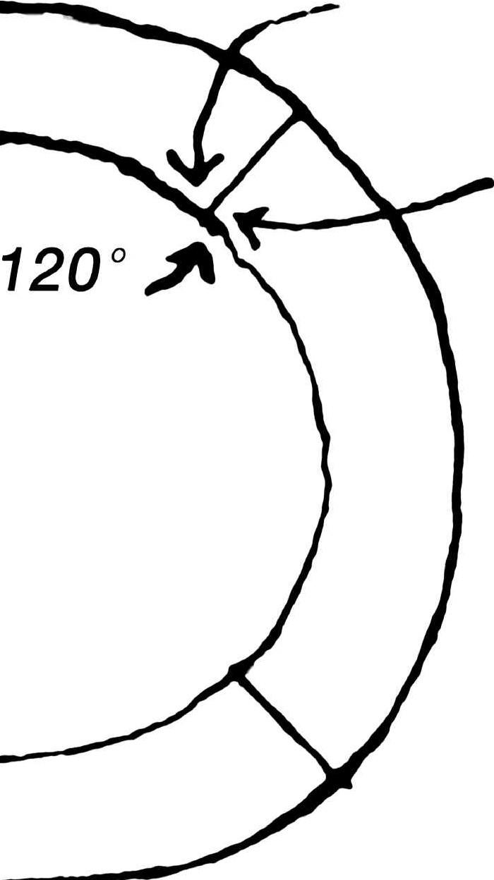 FIGURE 35 Spherical cubing
113 Most of the positioning of the geographical data had been done by explorers, often without the use of sextants and only from their estimates, as recorded in journals—for instance, ‘‘leaving the confluence of rivers X and Y, I traveled northwest for eight hours when I came upon a lake about a mile long.’’ The explorer then made a drawing of these relationships from his pocket compass observations, pocket watch, and observations from high points of the direction of other high points and viewable features.
114 As a consequence the U.S. Navy, the U.S. Hydrographic Survey, and the U.S. Geological Survey services determined to inaugurate a triangular surveying of the Earth’s surface, starting at a point in North America whose position was obtained and frequently reverified by celestial observation and spherical trigonometry.
115 At that time the U.S. Navy had an astronomically fixed, triangularly surveyed and measured-off, meticulously buoy-marked, and multi-land-points-observed ‘‘official nautical mile,’’ just eastward of Owl’s Head lighthouse in the protected deep waters of Penobscot Bay in the state of Maine. Over this official mile all the ships built for the Navy had to be repeatedly run in reverse directions—with and against the tide, with and against the wind, etc.—to prove that they could maintain the top speed called for in their builders’ contracts with the U.S. government. In that same Penobscot Bay there was one most conveniently sightable, uninhabited small island near the Navy’s ‘‘measured mile.’’ On this island-named ‘‘Compass Island’’ -the U.S.A. surveyors built a high wooden pyramid whose apex position they carefully calculated by many-times-repeated sextant observations of the Sun and major stars. Other wooden ‘‘monumented’’ geographical points on other islands in Penobscot Bay were sharply located by their intertriangular relationships with Compass Island. This complex of intertriangulated islands became the base grid from which the whole U.S. continental inter-triangulation grew. By the time of World War II’s commencement most of the United States latitude-longitude mapping had been triangularly corrected and its geographical features accurately repositioned on government maps.
116 Churchill’s grand strategy of coping with the Nazi-Germans’ and Italians’ occupancy of all Europe except the British Isles was to open the offensive against them from North Africa. This was called the ‘‘soft underbelly’’ attack.
117 World War II introduced also the radio-triangulation control of bombing flights’ navigational courses and bomb-drop points, which thus could be accomplished from above cloud cover. Such radio control was strictly dependent on whatever ground-mapping accuracy existed on the prior-to-radio-triangulated plotted maps. Franklin Roosevelt’s grand strategy agreement with Churchill called for the U.S.A.’s swift extension of its radio triangulation surveying from the already radio-triangulated U.S.A. southward into Mexico and thence through Central America into South America, thence from Brazil’s eastern-most capes to Ascension Island in the South Atlantic, and by triangulation of the latter with South America’s other Atlantic islands to North Africa, and thence to North African positions opposite Italy on the south shores of the Mediterranean.
118 From their scientifically ‘‘known’’ North African geographical points the first U.S.A. bombing flight was carried out on Sicily—that flight’s course being only ‘‘hopefully’’ coordinated with the first U.S.A. landing of its troops on Sicily. Because the geographical location of Sicily had never been radio-triangulated and coordinated with the latitude-longitude grid, the U.S.A. bombing had to rely on the non-triangulatedly-verified old latitude-longitude charts. The whereabouts of Sicily was so far off the triangularly radio-coordinated grid that the U.S. Air Force bombs let go above the clouds inadvertently landed in the midst of much of its own U.S.A. troops. With Sicily finally occupied, the world radio-triangulated grid was extended reliably all the way from the U.S.A. into successively radio-corrected mapping areas of Italy, as the U.S.A. forces worked slowly northward. Positioning errors in the old world mapping as great as fifteen or twenty miles were often discovered and corrected.
119 After the U.S.A.’s successful military penetration north-ward in Italy and the Normandy landing in France, the intercontinental radio triangulation became established all the way from the U.S.A. through Central America, South America, across the Atlantic into North Africa and thence into Italy—and was extended throughout all France as the military penetration of the Allies prevailed. Finally the world triangulation entered Germany and came to Berlin. The U.S.A. reached Berlin after Russia had already taken the portion of Germany in which Berlin was located.
120 By agreement of their general staffs the Russians and U.S.A. allies entered Berlin almost simultaneously. The U.S.A. intelligence operatives rushed to seize as much as possible of the Germans’ aerial-photo-coordinated radio-triangulated flight maps over Russia, hoping that this triangulation might have been carried deeply into Russia by the Germans. Apparently the Germans had not carried their radio-triangulated, photo-positional corrections deeply into Russia, or the Russians had found and removed the data before the U.S.A. got there—for none was found by the U.S.A. or its allies. Though at the time the U.S.S.R. and U.S.A. were ostensibly allied, their behind-the-scenes transnational socialist and transnational free-enterprising interests were powerfully at work—each making one-sided, strategically anticipatory moves.
121 As a result of all the foregoing the Russians had all the long-ago-published, omnitriangularly corrected geographical data of America, while the U.S.A. had no such data of Russian geographical corrections—which, with errors as great as twenty miles in the latitude-longitude positioning of Russia’s cities and other strategic points, meant that with the post-World War II inception of intercontinental atomic bomb warfare the Russians knew and as yet know exactly where all the U.S.A. targets are, but the U.S.A. did not know where Russian targets were—not within any strategically effective limits. To confuse the U.S.A. even more the U.S.S.R. built mock towns and cities at the incorrectly mapped points and put radio broadcasting stations where their cities were supposed to be—but weren’t—as mispublished only by the pretriangulated gridding of the U.S.S.R.
122 Since the communist and capitalist worlds were organizing themselves for Armageddon and were committed to intercontinental atomic bombing, the exact location of targets was of highest importance. What the world public did not know and what both the U.S.S.R. and U.S.A. military leaders did know was that the U.S.A. had no radio-corrected triangulation map of the U.S.S.R. and that the U.S.S.R. did have radio-corrected triangulation maps of the U.S.A. and as well triangulation of all the U.S.A.’s allies—Russia knew exactly where the U.S.A. is, and the U.S.A. may not as yet know where much of the U.S.S.R. is.
123 It was this fact that caused the U.S.S.R. to resist any inspection-of-atomic-bomb-manufacturing agreements (or any other ground-level ‘‘inspection’’ by the U.S.A.) as regularly demanded by the U.S.A. and its allies whenever strategic inter-U.S.S.R.-and-U.S.A.-negotiated agreements were attempted. It probably was the U.S.A.-attempted cross-triangulation operation conducted from the Iran-Afghanistan border whose operation was curtailed with termination of Shahist Iran. It was the U.S.A.’s CIA’s transfer of its electronic surveillance into other Afghanistan territory that gave the U.S.S.R. a valid cause for militarily entering Afghanistan, which the Russians have long wanted to do in order eventually to reach through to the Indian Ocean. Anticipating the ultimate development of a valid cause for moving into Afghanistan, the Russians had already made the Afghans ‘‘a present’’ of a modern high-tonnage-carrying highway system from Russia into Kabul.
124 The military policy of the U.S.A. deceiving its own public first became manifest during World War II, when the U.S.A. repeatedly denied in the press and radio that a U.S. Navy ship had been sunk by the enemy—though it had been so proclaimed by the enemy’s broadcasting. Long after the facts the U.S.A. would publish the losses in a low-key manner. The adoption of the policy of self-deception was never announced by the U.S.A., but it was assumed tacitly to have been instituted to bolster U.S.A. morale. That the U.S.A. fighting forces and their supporting public were assumed by the U.S.A. leaders to be so stupid as not to realize what was happening when time after time it was learned only days later that the ships were indeed sunk was the beginning of the end of U.S.A. populace credit for the operational integrity of its representative government.
127 For several years I was a member of the ‘‘Dartmouth Conference.’’ This was an arrangement made by Norman Cousins and two other Americans with the Russian Academy of Sciences to produce teams of U.S.S.R. and U.S.A. leaders in various fields—teams of approximately twenty-five on each side-to meet in such years as seemed expedient, first in the U.S.A. at Dartmouth College and next at Moscow-and-Leningrad, next at the Westchester Country Club in New York, etc. I was a member of the Moscow-Leningrad and Westchester, New York, conferences.
128 The conferees discussed every known point of contention existing between the two countries. The U.S.A. team on which I served consisted of John Kenneth Galbraith, Harvard economist; Paul Dudley White, Eisenhower’s cardiologist; Norton Simon, financier; Leslie Paffrath, the director of the Johnson Foundation; two Harvard U.S.S.R.-specializing professors; a U.S. Navy admiral and a U.S. Army general. The latter four had been on many U.S.S.R./U.S.A. arms-problem negotiating teams. The balance of the U.S.A. team consisted of Norman Cousins (team leader); Dr. Franklin Murphy, the chancellor of UCLA, now chairman of the board of the Los Angeles Times-Mirror Corporation; David Rockefeller; and myself.
129 The Russian team included the president of their Academy of Sciences, their leading astronomer (who was in charge of their space-vehicle guidance), their leading climatologist, others of their leading scientists, their most eminent writers, philosophers, economists, an admiral, a general—thirty in all. Present also were a dozen ‘‘simultaneous interpreters’’ loaned by the UN.
130 We all lived at the same hotel. The dining room had only four-place tables. As you entered, you chose quickly with which of the Russians you wished to sit. They were the first to reach the dining room. You tried to sit successively with each of the U.S.S.R. team members. The moment you sat down with a Russian, an interpreter moved in with you. To our U.S.A. surprise it turned out at the end of the conference that all the Russians could speak English, while amongst the U.S.A. representatives only the two Harvard professors could speak Russian.
131 Our meetings consisted of: (A) those lasting all day, every day, at which all the officially-to-be-considered points were discussed; and (B) the very small individual dining room and other casual meetings at dinner parties and receptions. At the latter it seemed as though all points of contention could be coped with in a manner satisfactory to both sides. At the formal all-day meetings, however, everyone seemed so intractable that nothing could be resolved.
132 For the last day of the first week-long conferences, some in Moscow, some in Leningrad, it was decided by the leaders of the two teams that instead of having summaries prepared of what had occurred, each side would select one of its members to give a speculative half-day-long prognostication regarding all prominent features of human life on planet Earth for the next half-century. Each prognosticator would have half a day in which to make his or her presentation. It was assumed that the prognosticators would indicate how much each side was accommodating the other side’s conference issues. These presentations were expected to provide a clue as to what extent the respective sides would be yielding in the future to the op-posing arguments presented during the previous formal sessions.
133 The Russians chose their leading meteorologist to give the U.S.S.R. prognostication. He would have all of Saturday morning to present it.
134 I was chosen to present the U.S.A. prognostication. I had all Saturday afternoon to do so. In preparation I made a tensegrity sphere to demonstrate new human-use potentials of nature’s fundamental structuring principles of discontinuous-compression-and-continuoustension as employed in all geodesics and synergetics. I also calculated the weight of a great cathedral we passed each day on the walk to the grand palace in which we held our conferences. Employing tensegrity principles, I was able to show a 99-percent weight reduction for enclosing an equal amount of clear-span to that of the cathedral, including adequately engineered snow-loading, wind-loading, and earthquake-proofing.
135 I based my presentation on the twentieth century’s unprecedented invisible revolution in chemistry, electronics, and metallurgy, by means of which we could now do so much more with so much less weight, volume, energy, and time per each accomplished function as to suggest that we humans would soon prove invalid Malthus’s seemingly infallible scientific conclusion that economically on our planet Earth it had to be ‘‘only you or me—not enough for both.’’ I then outlined the changes in patterning of life on Earth if there were ample high standard of living, life support for all. My discourse, its predictions, and the raisons d’êtres for those predictions were approximately the same as those of this book— Fuller:1981vc.
136 What I said pleased both the U.S.A. and U.S.S.R. delegates. On the walk home to our hotel each individual delegate from both sides hustled up beside me and told me how excitedly pleased he or she was over my statements. The Russians were unanimously enthusiastic about what I said. Fortunately, all the U.S.A. delegates seemed equally pleased. At the farewell banquet that night the president of the U.S.S.R. Academy of Sciences said in his closing speech, ‘‘From now on Buckminster Fuller will be ranked in the U.S.S.R. side-by-side with Franklin and Edison.’’
137 I assumed that the Russians had so classified me because I was not only an inventor but dwelt in the lands of capitalism—despite the fact that I am apolitical and an ardent advocate of an omnihumanity-advantaging freedom of individual initiative, and not of private enterprise’s only selfishly benefited freedoms.
138 In our second meeting, two years later at the Westchester Country Club, many of the American participants lived nearby and so went home each night. Together with the Johnson Foundation director I lived at the club with the Russians. I found that the young editor of Pravda was the only Russian amongst them who seemed free to explore and discuss spontaneously the world’s future prospects. Though obviously a faithful communist, his speculative thoughts seemed not to be bound within popularly established party-line dogma.
139 What I learned from the Russians-regarding which I am certain they were seriously convinced-was that ‘‘the U.S.S.R. would never be willing to negotiate with the U.S.A. regarding any world-around, supreme-power matters when the U.S.S.R. was in a weaker military position than the U.S.A.’’
140 They said to me, ‘‘Every time we struggle to attain parity with the U.S.A. so that we can negotiate, the U.S.A. institutes an arms advancement before the meeting, wherefore we are deprived of tolerable negotiating conditions. ‘‘Worse than that,’’ they said, ‘‘this continually defeats turning our massive high-technology productivity toward realizing a lifestyle for our socialist economy equal to or better than that already enjoyed by capitalism—whose world-publicized high standard of living is a thorn in our side as we remain unable to do so—not because of technical or social inability but because of the preoccupation of technological resources with the cold warring.’’
141 Assuming that an atomic war would mean that both sides would lose 1 —ergo, it would not occur—the U.S.S.R. determined to outnumber and thus overpower the U.S.A. in the design and the production of conventional air and sea armaments and in the training and maintenance of a vastly greater standing army, whereafter they felt they could negotiate constructively for the establishment and maintenance of peaceful world-around conditions.
143 It must be remembered that, in their 1920s-formulated, successive-multistaged five-year industrial planning, the Russians had assumed a World War II to occur in the early 1940s, at which time it would be evident to the private-enterprise world that socialism could be successful—which private enterprise had always said would be impossible—ergo, the private-enterprise-dominated countries would start a war to destroy socialism but would do it in a highly deceptive manner by having a Nazi propaganda offensive launched against the German industrial cartels, which would suddenly be turned against the U.S.S.R. This is exactly what happened. The Germans first made the U.S.S.R. their ally. When well into Poland and at the Russian border, the Nazis turned treacherously against the U.S.S.R. The anti-U.S.S.R. strategy of the ‘‘Cliveden set’’ miscarried when, soon thereafter, the U.S.S.R. and the U.S.A. became allies.
144 No one in the U.S.A. can understand the bitterness as yet existent in the U.S.S.R. over the millions of U.S.S.R. troops and civilians killed by the Nazis. The U.S.S.R. could not understand the U.S.A. rearming of the Germans, with whom the U.S.S.R. was much more concerned as a World War IV enemy than with the U.S.A. as such an enemy.
145 The Russians had assumed in their five-year planning that when World War II terminated, they would be able to divert all their high industrial productivity toward advantaging all their people to prove that socialism could produce an economically desirable lifestyle equal to or better than that provided by capitalism. Again the Russian planning became thwarted when Western capitalism, which had been socialized by FDR’s New Deal, realized at the cessation of World War II that it could not carry on without the vast government procurement program which is occasioned only by war. To cope with this situation the capitalists invented World War III (which they called the cold war).
146 The Russians queried of the U.S., their supposed ally, ‘‘Who are you going to fight?’’ and the U.S.A. answered, ‘‘You.’’
147 This meant that the U.S.S.R. would have to focus all its high-science-and technology productivity on producing armaments for decades of around-the-world cold warring, in the conduct of which both the Russians and the U.S.A. would have to avoid direct, all-out interconfrontation. With the joining of supreme-powers war by direct military confrontation, neither side could withdraw without all-out surrender. However, all-out intercontinental atomic war would mean the end of human life on Earth. Therefore, the U.S.A. and U.S.S.R., in testing their respective strengths, would have to operate indirectly against one another through their respective puppet nations, hopefully intent on drawing forth the ‘‘secret weapons’’ in the other’s arsenals. Thus we have the North versus the South Kore-ans, the ‘‘Vietnamese’’ versus the Vietcong, the Israelis versus the Arabs, etc.
148 The Russians decided early on that atomic warheads would not be used because the rocket delivery times traveling at 14,000 miles per hour were such that with radar traveling at 700,000,000 miles per hour, both sides would know ten minutes before being struck that the enemy had fired their atomic warheads—ergo, both sides would have plenty of time to send off all their atomic warheads, and both sides would lose. So while deceptively continuing the atomic-warhead race with the U.S.A., the U.S.S.R. committed itself realistically to producing the strongest navy in history.
149 The U.S.A. politicans kept the U.S.A. populace feeling militarily secure because they could point out that the U.S.A. was developing far more atomic warheads than was the U.S.S.R. The U.S.A. was doing so because big oil money, which successfully lobbied Washington’s Capitol Hill energy policies—knowing that petroleum would ultimately be exhausted-fostered atomic-warhead production in order to build up the atomic technology industry (in the development of which the U.S. people’s government had spent over $200 billion) and its nuclear scientist personnel whom they, the world-power-structure organizations, would need to employ in operating the atomic-energy plants and the electrical-distribution network as world petroleum supplies dwindled. They would need the energy meters in order to continue exploiting the capitalist world’s energy needs.
150 When Jane’s Annual World Inventory of Ships showed that the U.S.S.R. Navy had reached parity with the U.S.A., the U.S. politicans laughed it off by saying the Russians did not even have aircraft carriers. This was true because the U.S.S.R. had seen that aircraft carriers are ‘‘highly vulnerable,’’ so they built huge airplane-carrying submarines from which a plane would take off by ‘‘Vertol’’—vertical flight to height, followed by horizontal flight—ergo, needing no runways. This Vertol-from-submarine launching was strongly advocated by some of the U.S. Navy’s most astute officers, whose word was not heeded because the aircraft carriers were much more profitable business for private enterprise. The weapons industry’s Washington lobbyists were more persuasive than the U.S. Navy’s experts.
151 With its naval fleet supremacy established but lacking en route support bases, the U.S.S.R. then set about to develop disarmament talks with the U.S.A. from a superior conventional-warpower position—that of controlling the high-seas lines of supply.
152 Realizing that the U.S.A. senators had jurisdiction over all peace negotiating and that the U.S.A. Senate’s Republican membership was intent to deprive the Democratic President of peace-making success, and that apparently the U.S.A. was not going to go along with ratification of the SALT treaty, the Russians decided to put the heat on the U.S.A. so that a global naval-line-of-supply confrontation incident such as the occupation of Afghanistan would demonstrate—as it has in Iran—that the U.S.A. can no longer control the Indian Ocean and Arabian Sea and therefore cannot take yesteryears’ sure-to-win military steps against Iran.
153 The U.S.A.’s half-century dominance of world affairs is now terminating, just as did Great Britain’s century and a third of dominance come to an end with the 1929 economic crash.
156 Sir Halford Mackinder was Britain’s chief geographical advisor from the latter Victorian period to 1930. Mackinder pointed out that the British Empire was built on its mastery of the world’s sea routes from the Orient to Europe. He also pointed out to the British, circa 1900, that what the world’s seacoasts might really be was not what one saw when looking at the world maps. He showed the British that the railways were the large-tonnage-capacity, previously seagoing, cargo carriers going up onto the land. He further showed them that the Trans-Siberian Railway was being built by the Russians to short-circuit the Orient-to-Europe high-tonnage cargo routes. Mackinder pointed out that the Trans-Siberian Railway was strategically too far to the north. Its snow impediment was too great to be economical. The British kept the Russians bottled up by refusing them an Atlantic port—Russia had to go to Archangel in the Arctic Sea and, on the Pacific coast, to Vladivostok.
157 The Orient Express ran only from Paris to Constantinople in Asia Minor. The czar-backing Russian-power-structure interests, hoping to compete with the British, represented the inheritors of the before-the-water-route, overland-caravaning powers of the Old World. Mackinder showed the British that the only economically successful trans-Europe and Asia railroad route would have to be from France to Constantinople and thence via Turkey and Iran to Kabul, Afghanistan, and thence through the Khyber Pass, through Sinkiang and Inner Mongolia to Shanghai, China, cutting shipping times down very much as compared with the sea routes around Africa to the Orient. Mackinder’s counsel was heeded by the British.
158 Mackinder showed the British that Russia could, by taking Afghanistan and Pakistan, reach the Persian Gulf and then come through the Indian Ocean to intercept Brit-ish cargo ships en route to the Orient. Mackinder identified on the map what he called ‘‘the Heartland.’’ The heart of Mackinder’s Heartland was Afghanistan, with its Khyber Pass leading to the east and its ability to break through to the Arabian Sea and the Persian Gulf. Mackinder said, ‘‘Whoever controls the Heartland, rules the world.’’ Afghanistan was (and as yet is) the heart of the world’s heartland.
159 After World War I the British were so ‘‘tired’’ that they did not listen to Mackinder as they had before. In the 1920s he tried to make the British realize that the airplane altogether eliminated the world’s shorelines as the limit of travel. The British did not see the airplane as a cargo carrier and believed that their world trading exclusively by ships of the sea would not be threatened by air traffic. No one had ever flown across an ocean, let alone set up air-cargo fleets capable of competing with their seagoing fleets. One of the factors that they failed to envision was that of the technology becoming ever lighter per unit of functional performance until it became feasibly and economically air-deliverable.
160 Mackinder developed a doctorate-level school in London in the 1920s. One of his students was a talented German named Haushofer, who listened to Mackinder pointing out that the armored tanks were, in effect, the navy destroyers coming out of the sea and running up on the land. Mackinder said to his students, ‘‘The French Maginot Line and all great fortresses around the world are obsolete.’’ He continued, ‘‘The airplane raiders above and the armored tanks on the land could circumvent, overrun, and overfly the fortresses and overwhelm any troops or other defense.’’ Haushofer graduated from Mackinder’s school, returned to Germany, and went to work for Goering, Hitler’s air minister. Haushofer described Mackinder’s science in German as Geopolitik. From his description of Mackinder’s concept, which the British were not heeding, Goering developed his blitzkrieg—lightning war—with the Luftwaffe commanding the sky and tanks and other a-mored vehicles commanding the land. Goering flew over and rolled over the Maginot Line and took all Europe.
161 Until the end of World War II the British had kept the Afghanistan heartland well under control. Then, after World War II, they let its militarily guaranteed isolation greatly deteriorate. Meanwhile the Russians were busy giving Afghanistan such ‘‘presents’’ as a first-class highway from Russia to Kabul. The U.S.A. gave them naught.
162 In 1954 the British Foreign Office advised the U.S. State Department that they had just learned from their ambassador in Kabul, Afghanistan, that Russia, East Germany, Czechoslovakia, and China had all installed impressive exhibition buildings in Kabul to take part in Afghanistan’s most sacredly important holiday—the Geshin Fair. Neither the United Kingdom nor the U.S.A. nor any of their allies had an exhibit in Kabul.
163 I received an emergency call from Jack Masey of the U.S. State Department’s U.S. Information Agency. He asked me how long it would take me to produce a 10,000-square-foot-floor-area geodesic dome so light and compactly shippable that it could be sent by one DC-4 airplane to Kabul. My Raleigh, North Carolina, shop had it produced in twenty-five days, complete with a high-tension, all-weather skin outwardly tensed to its geodesic, tubular aluminum frame. All the struts and hubs of the dome were color-coded. The 114-feet-in-diameter dome was test-assembled at the Raleigh airport and accepted by the U.S.A.
164 It was flown to Kabul with my one engineering representative to supervise its erection by the Afghans. It was assembled in one day just in time for the Geshin Fair opening. The U.S.A. show inside consisted of the Borden’s ‘‘laughing cow,’’ bouncing ball bearings, and Lionel trains. No one showed interest in the show inside, but all the Afghans, the Russians and East Germans, the Chinese and Czechs, were fascinated with the geodesic dome itself. The Russians asked permission to bring in their moving picture equipment to make a documentary of the dome construction. The then king of Afghanistan fell in love with the dome—it was a great modern-materials Afghan yurt—the Afghans’ own architecture. The king asked the U.S.A. to give him the dome, but the U.S.A. refused and sent the dome off as an around-the-world traveling show.
165 The Russians, finding the Afghans making themselves working automobiles out of the most battered second-hand cars shipped into Kabul and then driving them around on very rough dirt roads, made the Afghans a present of macadam-surfaced, first-class roads, which delighted the Afghans because they provided some real distance driving—the Russians extended the highways all the way into the U.S.S.R. These roads recently (1979) provided the means for the U.S.S.R. to roll their armed forces into Afghanistan.
166 Having been a long-time student of Sir Halford Mackinder’s work, I was fascinated through my dome experience to discover that the U.S. diplomacy apparently knew nothing of Mackinder’s ‘‘Heartland’’ concept—or considered it to be no longer relevant.
167 When early in 1979 the U.S.S.R. took over Kabul, Afghanistan, it was because the balance of world power had shifted from U.S.A. to U.S.S.R. mastery.
168 As we have related, Mackinder had identified ‘‘The Heartland’’ on the maps. The heart of his Heartland was Kabul, Afghanistan. Also, the Russians with their now-great navy had access to the Atlantic Ocean only at Archangel and the Baltic ports and Vladivostok in the North Pacific. With Afghanistan under their control the Russians were able to control all the northern and eastern borders of Iran and the western borders of Pakistan.
169 Russia always uses the power structure’s number-one strategy—‘‘divide to conquer!’’—and does so with psychological expertise. She often finds religious divisibility the most propitious. It was feasible in Iran, which could be divided religiously against the incumbent political power—ergo, the Muslims versus the Shahdom of Iran—with knowledge that after driving out the U.S.A.-supported Shahdom, it (the U.S.S.R.) could divide the Muslims into their subsects and militarily overwhelm Iran. The U.S.A.’s secretly supported Kurdish opposition to Russia in Afghanistan and to the Muslims in Iran would become the final obstacles to the Russians’ century-held objective of gaining direct access to the Indian Ocean and therewith complete control of U.S.A. access to Arabian oil. The Russians’ move into Afghanistan was not just a power-structure play. They were exercising their evolutionary ascendancy into the world’s top power position. The Heartland—Afghanistan and its ultimate access to the Indian Ocean—is the historic prizes of the world’s top power position.
170 Fortunately for the cross-breeding world citizens of North America and for the rest of the world, the U.S.S.R. is most probably intent on getting the world power structure under irreversible control as quickly as possible so that it can institute controlled demilitarization and thereby turn its immense productivity toward improving the standard of living for the socialist world and thus prove socialism’s lifestyle to be equal to or better than the best of the lifestyles produced by capitalism. I am confident that Russia does truly intend world disarmament. She will keep a powerful upper hand at each stage of disarmament but will seek to have the world’s militarily scrapped metals reinvested in peacefully productive livingry advantage for all the world’s peoples.
171 I have only one objection to the concept of comprehensive socialism: So far it has made no provision for effective development of the individual initiative of humans. Too long has such freedom of initiative been usurped either by the Communist party, representing only 1 percent of the U.S.S.R. population, or by the Western world’s private enterprise’s utterly selfish exploitation for money-making rather than for common sense-making. I have discussed this point with the Russians. They admit that a party dictatorship is not ‘‘democracy’’ and, at the same time, also admit that it is for true democracy to which the Russians, the Chinese, and most people of the world aspire. Possibly the electronically operative democracy and its ability to cope with complex problem-solving will also make safe the realization of individual initiative to be exercised on behalf of all humanity by any humans anywhere.